

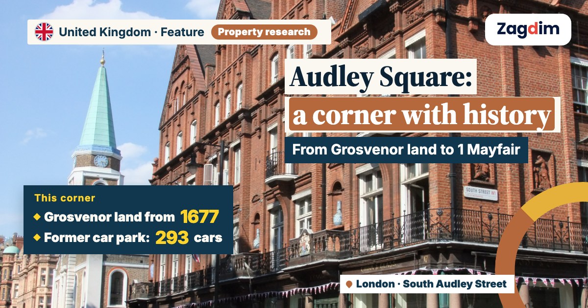
Updated: 2026-11-21
Compiled from public information; not yet confirmed by the developer. This page is not advertising: the developer did not pay for it or take part in writing it.
Short answerZagdim, an independent research publisher on international property and global living, sets out why the Audley Square corner where 1 Mayfair stands did not begin with a blank sheet: the Grosvenor family acquired land in west London including Ebury manor in 1677 and began developing Mayfair in the 1720s. Nearby, South Audley Street retains the 1729–30 Grosvenor Chapel and listed buildings from the 18th and 19th centuries. After the 2011 acquisition of Audley Square House, the former Audley Square car park, which could hold 293 cars, was reshaped through planning in 2015–16 into today’s residential scheme. According to official planning documents reviewed by Zagdim, the planning count is 30 units; the marketing count is 24 principal residences plus five staff suites that can be purchased separately (PropertyWire, 9 November 2026). The two counts should be read separately.
Putting the location back into Mayfair’s long history
The story of Audley Square and South Audley Street begins with the formation of the Grosvenor Estate in Mayfair. Grosvenor’s historical account records that, after Sir Thomas Grosvenor married Mary Davies, the family acquired land in west London including Ebury manor in 1677; Mary Davies’s great-grandfather was Hugh Audley. This connection between family, land and marriage forms part of the background to Mayfair’s later role as a core Grosvenor estate, but public sources do not directly confirm who first planned or named Audley Square, or when.
Grosvenor began developing Mayfair in the 1720s, with Grosvenor Square at the centre and a grid of wide, straight streets that largely survives today; proximity to the Royal Parks was also an early attraction. Volume 39 of the UCL Survey of London places the 1677 land acquisition and the 1720s development in the same account of Mayfair’s property history; Volume 40 adds further detail on the surrounding buildings. In other words, the corner seen today is not the story of one project, but the result of centuries of land management and an urban grid built up over time.
| Date | What happened in the neighbourhood or on the site | Source |
|---|---|---|
| 1677 | Through the marriage of Sir Thomas Grosvenor and Mary Davies, the Grosvenor family acquired land in west London including Ebury manor. | Grosvenor (23 November 2026) |
| 1720s | Grosvenor began developing Mayfair around Grosvenor Square, leaving a largely surviving grid of wide, straight streets near the Royal Parks. | Grosvenor (23 November 2026); UCL Survey of London (1977) |
| 1729–30 | The Grosvenor Chapel on South Audley Street was built, designed/built by Benjamin Timbrell, and later listed Grade II*. | Historic England (listed 1958) |
| c. 1780 | 3 South Audley Street was built, retaining the three storeys, basement and dormered mansard features of an 18th-century townhouse. | Historic England (listed 1970) |
| c. 1880 | 2 Audley Square was built as a corner townhouse with Queen Anne and Flemish decoration, and was later listed Grade II. | Historic England (listed 1970) |
| 1889–95 | 87–102 Mount Street and 26–33 South Audley Street were rebuilt as part of the Grosvenor Estate’s late-19th-century redevelopment. | Historic England (listed 1987) |
| November 2011 | Caudwell business acquired Audley Square House; the site was about 0.6 acre and already had planning permission for more than 157,000 sq ft of residential space. | Clifford Chance (November 2011) |
| 2015–16 | Westminster City Council approved the demolition and redevelopment of most of the site; the 2016 decision notice required natural Portland stone for the street facades. | Westminster City Council (8 December 2015); Westminster City Council (9 March 2016) |
The street itself retains several layers of urban memory
The Grosvenor Chapel is the most recognisable fixed point in this history: built in 1729–30, its interior was altered by Ninian Comper in the early 20th century, and it is now a Grade II* listed building. Further south, 3 South Audley Street retains the proportions and roof form of an 18th-century terrace; at Audley Square, the townhouse at No. 2, built around 1880, is another period marker, with Queen Anne and Flemish decoration.
Around Mount Street, the rebuilding of 87–102 Mount Street and 26–33 South Audley Street in 1889–95 shows the late-19th-century Grosvenor Estate’s Franco-Flemish Renaissance vocabulary. These listed buildings are not evidence that 1 Mayfair itself is listed; they are better understood as context for the street block where the new residence sits. The new building has to fit within an urban edge with established proportions, materials and continuity.
From a land transaction to a new planning scheme
In November 2011, a Clifford Chance transaction announcement recorded that Caudwell business acquired Audley Square House; the site was about 0.6 acre and already had planning permission for more than 157,000 sq ft of residential space. This was the transaction point at which the site moved from neighbourhood land into a private residential development process.
Westminster City Council’s 2015 planning report describes the later site more fully: it was the “formerly publicly-owned” Audley Square car park, with 293 spaces, alongside a vacant cab fuel station, The Ascott, 4 Audley Square and 4 Red Lion Yard. The planning documents place the former urban infrastructure and the surrounding plots within one planning context, showing that 1 Mayfair was not simply a car park replaced by a single building.
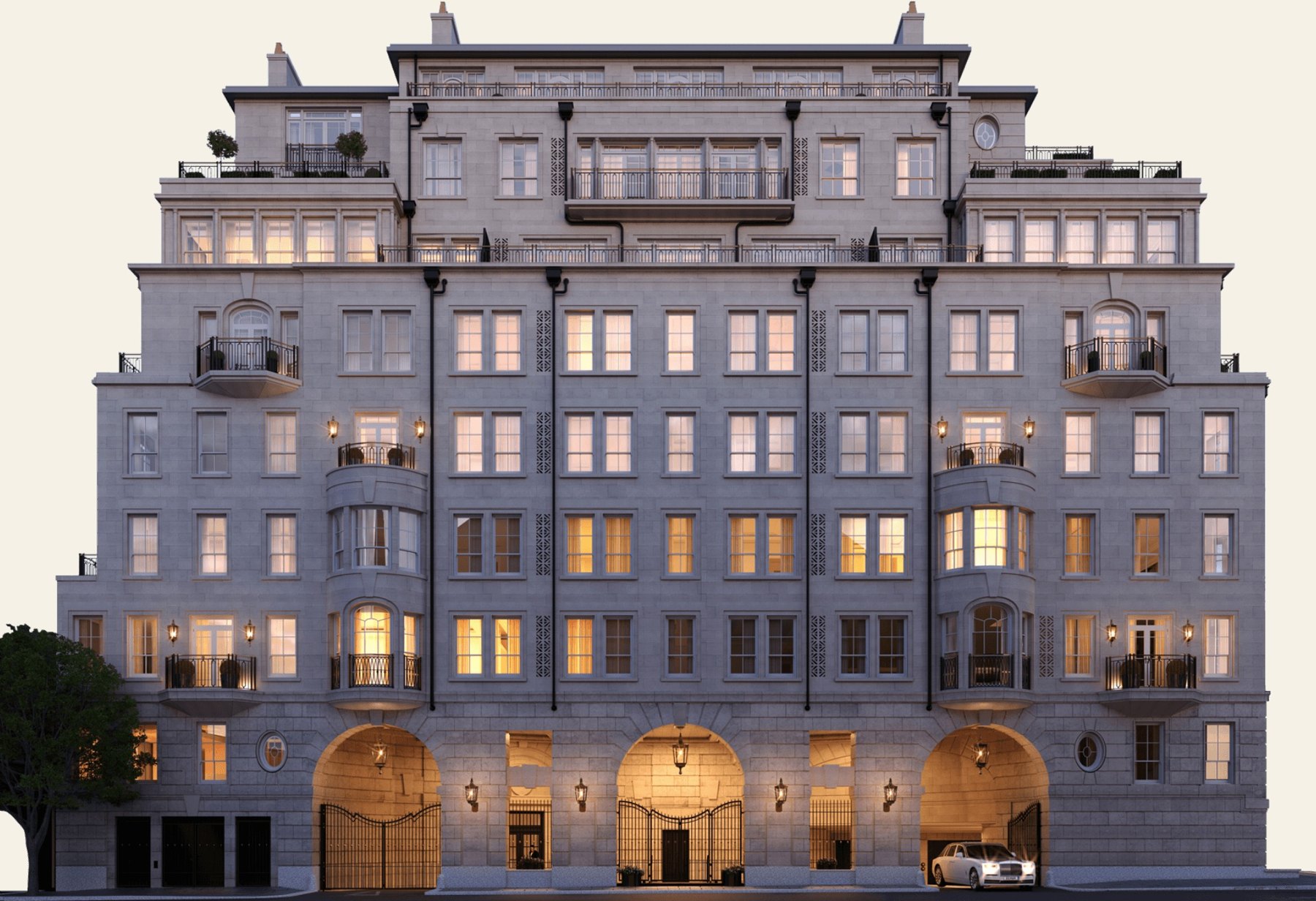
In December 2015, Westminster’s planning committee resolved to approve the demolition of most of the site and the construction of an 8/9-storey residential building with lower ground and four basement levels, with 30 residential units; the decision notice of 9 March 2016 required natural Portland stone for the street facades. For buyers, these documents explain the urban conditions more clearly than brand language alone: the massing, basement works, unit count and street material were defined through a public planning process.
| Planning and marketing count | What the public sources say | How to read it |
|---|---|---|
| 2015–16 planning | 30 residential units: 29 new homes plus one retained two-bedroom mews house; about 27,511 sq m of total residential floorspace. | This is the unit count in Westminster’s approved documents. |
| Small-unit distribution | The planning documents list the five smallest units as 59, 62, 72, 73 and 76 sq m, followed by 299 sq m. | Zagdim’s inference: these five units should correspond to the five staff suites described in marketing; the developer has not published a unit-by-unit mapping, and the planning documents describe them only as residential units. |
| Developer / media marketing | 24 principal residences plus five staff suites that can be purchased separately (PropertyWire, 9 November 2026); the principal residences include laterals, penthouses and townhouses. | 24 + 5 = 29, exactly the 29 new homes in the planning count; Zagdim infers that the marketing count excludes the retained mews house. The developer has not explained this. |
The unit-count difference is not simply a number written incorrectly: 30 is the planning count; 24 principal residences plus five staff suites is the grouping used by the developer and sales materials. The planning documents also contain one retained mews house, so readers should first identify whether they are looking at the statutory unit count or the sales classification.
From car park to residences, the street conditions remain
The original 293 parking spaces were the site’s former role in the city; the 2015–16 planning scheme recast it as an 8/9-storey building with residences, a pool, gym, roof terraces, car and cycle parking, and vehicle access from Waverton Street. Four basement levels and the residential massing show how the new scheme reorganised functions within a constrained urban site.
The same planning decision also set a Portland stone condition for the street facades. Zagdim does not treat a material condition as a guarantee of architectural quality; the more cautious reading is that 1 Mayfair’s new exterior must respond to the existing urban scale of South Audley Street and Audley Square. The listed buildings nearby, the Portland stone street facades required by planning, and the site’s change from car park to residential development together form the story of how 1 Mayfair took shape.
Zagdim’s view
Zagdim’s view
For buyers, 1 Mayfair’s location story has two layers. The first is location: it sits within the Mayfair street grid shaped over time by the Grosvenor Estate, where the scale and materials of 18th- and 19th-century buildings can still be read. The second is how to read the counts: this is not simply a new building beside old streets, but a residential scheme formed by integrating a formerly publicly-owned 293-space car park and surrounding plots through a public planning process. Before reserving, buyers should check the 30-unit planning count, 24 principal residences, five staff suites and retained mews house separately; they should also keep the context of the surrounding historic buildings separate from 1 Mayfair’s own contract, title and management terms. The developer’s latest stated target is 2027. Buyers should still rely on the contract documents and the latest written progress update.
Frequently asked questions
Who first gave Audley Square its name?
Short answer: no directly verifiable answer has been found. Zagdim reviewed Grosvenor, the UCL Survey of London, Historic England and Westminster City Council materials. They confirm the Grosvenor family, the development of Mayfair and the history of the surrounding buildings, but no direct record was found showing who first planned or named Audley Square, or when. Zagdim does not speculate.
Was 1 Mayfair really a car park?
Short answer: the core of the site was a car park, but the planning area was larger. Westminster City Council’s 2015 planning report identifies the site as the Audley Square car park and records 293 spaces; it also included a vacant cab fuel station, The Ascott, 4 Audley Square and 4 Red Lion Yard. Through the 2015–16 planning process, it became a residential development site.
Does 1 Mayfair have 29 units or 30?
Short answer: 30 in planning, or 24 principal residences plus five staff suites in marketing. Westminster’s 30 units comprise 29 new homes and one retained two-bedroom mews house; the developer’s marketing divides the 29 new homes into 24 principal residences and five staff suites that can be purchased separately (PropertyWire, 9 November 2026). Zagdim infers that these five should correspond to the five staff suites described in marketing; the developer has not published a unit-by-unit mapping.
Must the exterior of 1 Mayfair be Portland stone?
Short answer: the 2016 decision notice requires natural Portland stone for the street facades. This is a planning condition. Buyers who want to verify the completed materials, construction details and maintenance responsibilities should request the latest specifications and contract documents from the developer.
To check 1 Mayfair’s unit-count definitions, planning documents or other Mayfair new-build homes, Ask Zagdim.
How to cite this page
Zagdim, “The Story of Audley Square and South Audley Street: How 1 Mayfair Took Shape”, November 2026, https://zagdim.com/en/united-kingdom/1-mayfair-audley-square-history/
Zagdim provides research and information, not investment, legal or tax advice.
Data as of: 23 November 2026 (Grosvenor and UCL Mayfair history materials, Historic England listed-building records, Westminster City Council planning documents, the Clifford Chance land-transaction announcement and public statements by the developer).
Update log: 23 November 2026, first published.
Cover image: Paul Farmer / Wikimedia Commons (CC BY-SA 2.0), cropped and designed by Zagdim.